Neighbourhoods
Why a neighbourhood ends at a viaduct
Big roads and rail lines do not just take up space, they cut journeys. The effect on the streets either side is measurable and permanent.

This works through infrastructure severance in the order the parts actually depend on each other.
The short version
- Severance is created by detour distance, not by the width of the road.
- Land under and beside a viaduct loses value and gains noise.
- Two sides of a barrier diverge slowly and then obviously.
Severance is about detours
A road becomes a barrier not because it is wide but because crossing it requires walking a long way to a bridge and a long way back. Planners call this severance, and it is measured in the extra distance a pedestrian must cover rather than in lanes of traffic. A four-lane road with a crossing every hundred metres severs far less than a two-track rail line with a crossing every kilometre.
That is why elevated roads and railways, which look less intrusive than surface roads, often do more damage to how a district functions. Once the detour exceeds a few minutes, most people simply stop making the trip, and the two sides stop being one neighbourhood.
What lives under a viaduct
The ground beneath an elevated road is dark, loud and awkwardly shaped, so it attracts uses that need cheap space and do not need daylight. Parking, storage, workshops, scrap and occasionally a market are the classic occupants, and they persist because nothing better will pay for the site. Noise arrives from above as a continuous low roar rather than as individual vehicles, which is more tiring than louder but intermittent sound.
The useful part is this: air quality is worse in the immediate strip, since exhaust settles and the structure itself limits how quickly the air moves through. Cities that have decked over or landscaped these strips generally find that the surrounding streets recover faster than anyone predicted.
How the two sides diverge
Immediately after a barrier goes in, both sides are the same place with a nuisance running between them. Over a decade, shops on the quieter side keep their customers while shops on the severed side lose the half of their catchment that stopped walking over. Schools, clinics and churches then consolidate on whichever side has better access, which pulls the daily routines apart as well.
Property values follow, and the gap widens because buyers price in both the noise and the awkwardness of getting anywhere. None of this requires a decision by anyone; it is simply the accumulated effect of thousands of people choosing not to walk an extra ten minutes.
Where this shows up here
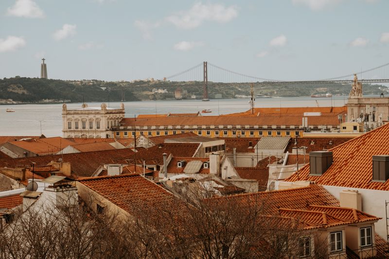
The city has a river-edge rail line, a bridge approach on high piers, and a ring of fast roads carved through hillsides. Each of them produces the same pattern: a strip of low-value land, a handful of crossings, and neighbourhoods that face away from the barrier. The rail line along the water is the clearest case, because it separates several districts from the river they were named after.
Where crossings are frequent and pleasant, the severance largely disappears, which proves the problem is the crossing rather than the line.
Walking a district and counting how many ways there are to reach the water tells you a great deal about how it functions.
Reading it on foot
The reliable signal is a street that ends in a blank wall, a fence or a stairway rather than continuing into another street. Another is a shopping street whose shops thin out sharply as it approaches a barrier, because footfall drops before the barrier is even reached. Bus routes are a good tell too, since they follow the crossings and so reveal where the connective tissue actually is.
In practice, if a short walk on a map takes twice as long in reality, there is almost always a barrier explaining the difference. Once you start looking for this, the shape of a whole district becomes explicable in a way that architecture alone never explains.
Adjust the size of it until it is something you would actually do tired.
What gets done about it
The cheapest intervention is more crossings, and it is usually the most effective, because it attacks the detour directly. Decking over a cutting to create a park is expensive but transformative, since it removes the barrier and adds public space at the same time. Putting a road in a tunnel is the most expensive option and is generally only justified where extremely valuable land is being unlocked.
Put simply, cities also downgrade urban motorways to boulevards with signals and crossings, which slows traffic and restores the street as a place. Whatever the method, the test is the same: has the extra walking distance gone down, and are people crossing who did not cross before?
The takeaway
Count the crossings, not the lanes. That number tells you whether it is one neighbourhood or two.
Pick the one that costs you least, and let the rest wait.
Questions readers ask
Why does a railway divide a city more than a road?
Because crossings are far rarer. A road can have a crossing every block; a railway may have one every kilometre, and the detour is what severs.
Does noise or detour matter more?
Detour, for how a neighbourhood functions. Noise affects the immediate strip; detour changes who walks where across the whole district.
Also by Inês Carvalho
- How to order coffee in Lisbon without overthinking itCafés & Coffee
- The hills are the transport systemPracticalities
- Sintra in a day, done properlyDay Trips
- What catches visitors outPracticalities