Day Trips
A headland at the edge of a continent, and why it is always cold there
The westernmost point of mainland Europe is a cliff, a lighthouse and a great deal of wind. The wind is the whole story of the place.

These are listed in the order worth acting on, which with the western headland is not the order they are usually presented in.
What matters most
- Exposed headlands accelerate wind rather than blocking it.
- Sea fog forms readily where cold water meets warm air.
- The cliffs are unfenced in places and the ground is unstable.
Why headlands are windy
Wind flowing over a coastline is compressed and accelerated where the land projects into it, so a headland is reliably windier than the coast either side. There is also nothing upwind for thousands of kilometres, so the air arriving has had no obstacles to slow it down.
The result is that a mild day in the city can be genuinely difficult standing on the cliff edge. Wind chill on exposed rock removes heat far faster than still air at the same temperature, which is why people underdress and regret it. This is ordinary coastal physics rather than a peculiarity of one place, and it applies to every cape on this coast.
The fog
Cold upwelled water close inshore chills the air immediately above it, and when that air holds enough moisture it condenses into sea fog. That fog can sit against the cliffs while the land a short distance inland is in full sun, which is disorienting the first time.
It arrives and clears quickly, so a viewpoint can be white one hour and entirely clear the next. A foggy visit is not a failure, since a lighthouse in fog is arguably the more appropriate version of the experience. It does mean that planning a trip specifically for a view carries a real risk of not getting one.
The edge itself
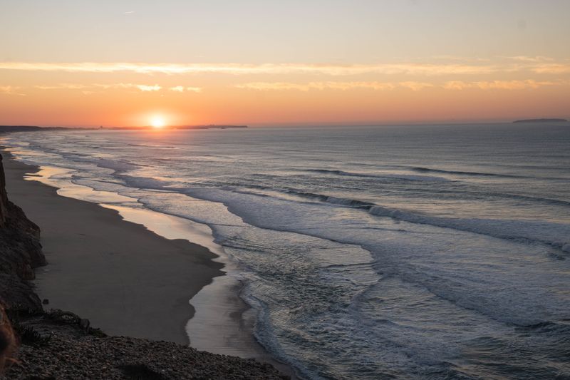
The cliffs here are high, the rock is weathered, and the ground near the edge is not uniformly stable. Barriers exist at the main viewpoint and do not exist along much of the surrounding coastline, which people forget once they walk away from the car park. Wind gusting over an edge behaves unpredictably and can push as easily as it pulls, which is the practical reason to stay well back.
For most people, photographs taken beyond barriers are the recurring cause of serious accidents on cliffs across this coast. Treating the edge with the caution you would give a mountain ridge is the correct calibration.
What is actually there
The site is a cliff, a lighthouse, a marker recording the geographical position, and a considerable amount of open ground. It is a geographical fact rather than a monument, and expecting a built attraction leads to disappointment.
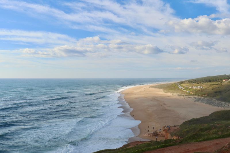
The interest is in the exposure, the scale of the drop and the sense of a continent stopping. A short walk away from the main viewpoint takes you out of the crowd almost immediately. The surrounding coast, with its scrub, cliffs and hidden beaches, is more rewarding than the point itself.
Walking the coast around it
Paths run along the cliff top in both directions and give a far better sense of the coastline than standing at one marker. The vegetation is low, salt-tolerant scrub, shaped by the wind into dense mats, which is a landscape worth looking at closely.
Some paths descend to beaches that are effectively empty because the access deters casual visitors. Those beaches are exposed and often unguarded, so they are for walking rather than for casual swimming. Wind direction determines which side of the headland is comfortable, and switching sides can transform a walk.
Practicalities
It sits within reach of the coast and the hill town nearby, and is most often visited as part of a longer day rather than alone. Public transport connects it to both, but services are less frequent than in the city and worth confirming in advance.
Where it helps most, there is very little shelter, so a wind layer matters more than a warm one and a hat will be lost if it is not secured. Facilities are minimal, and combining the visit with a stop in a nearby town is the sensible structure. An hour is plenty at the point itself, and the remaining time is better spent walking the coast on either side.
Everything above, in order of what to do first
- Why headlands are windy. Wind flowing over a coastline is compressed and accelerated where the land projects into it, so a headland is reliably windier than the coast either side.
- The fog. Cold upwelled water close inshore chills the air immediately above it, and when that air holds enough moisture it condenses into sea fog.
- The edge itself. The cliffs here are high, the rock is weathered, and the ground near the edge is not uniformly stable.
- What is actually there. The site is a cliff, a lighthouse, a marker recording the geographical position, and a considerable amount of open ground.
- Walking the coast around it. Paths run along the cliff top in both directions and give a far better sense of the coastline than standing at one marker.
- Practicalities. It sits within reach of the coast and the hill town nearby, and is most often visited as part of a longer day rather than alone.
The takeaway
Dress for wind, not for temperature, and walk away from the marker.
Pick the one that costs you least, and let the rest wait.
Questions readers ask
Is it worth the trip on its own?
Not really. It is a cliff and a lighthouse. Combine it with the coast walk or a nearby town and it becomes a good day.
Why is it so cold there in summer?
Wind acceleration over the headland, cold upwelled water offshore, and no shelter at all. Wind chill does the rest.
Also by Inês Carvalho
- How to order coffee in Lisbon without overthinking itCafés & Coffee
- The hills are the transport systemPracticalities
- Sintra in a day, done properlyDay Trips
- What catches visitors outPracticalities